
About
GT Flood
GT Flood is a powerful, AI-driven product that delivers near real-time and accurate flood detection, impact assessment, and water depth mapping. Designed for emergency services, insurers, and infrastructure operators, our product combines multi-sensor satellite data from LEO and CCM missions with AI and advanced data fusion to deliver actionable insights within hours of an event.
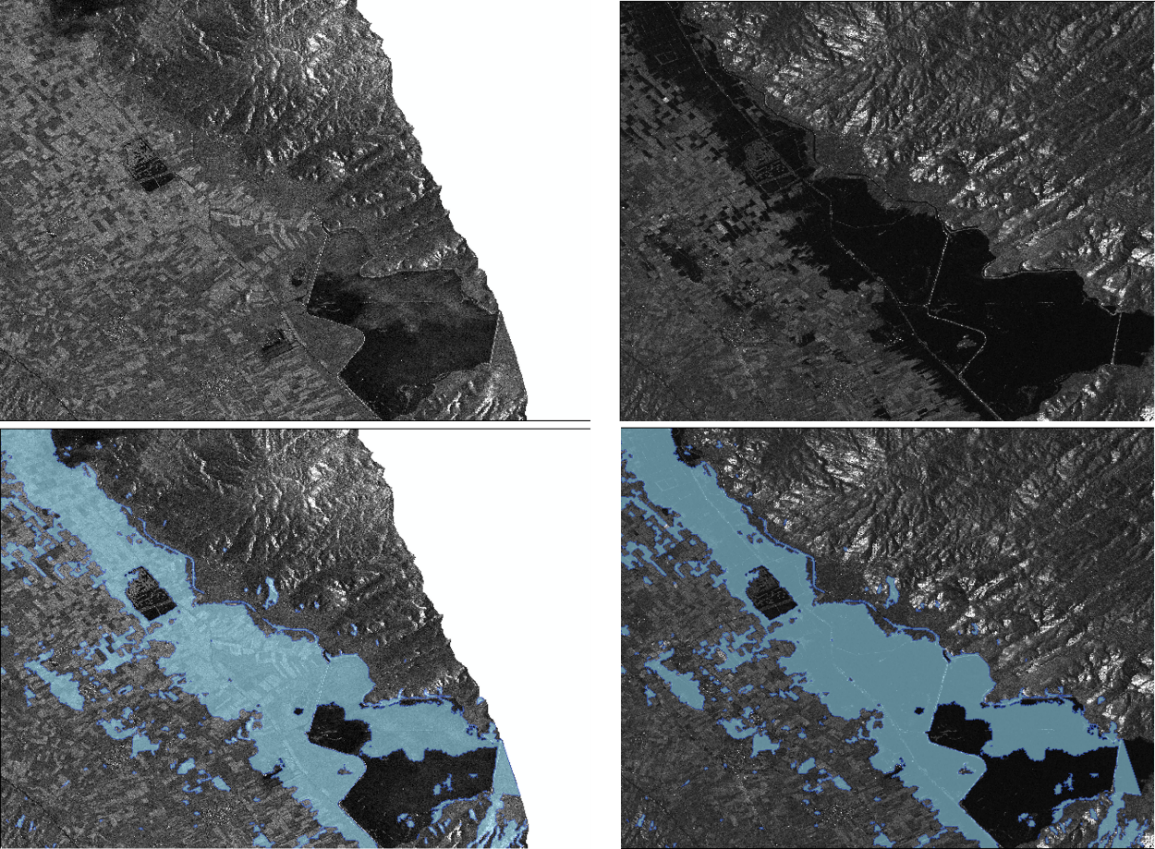
Flood Detection
Flood Impact Analysis
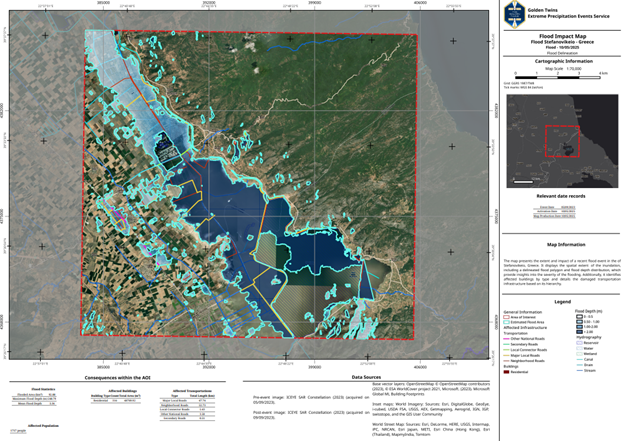
Tailored Notifications & Reports
Personalized alerts and automated reports delivered via web dashboard and email
Supports both real-time emergency response and long-term planning