About
GT Fire
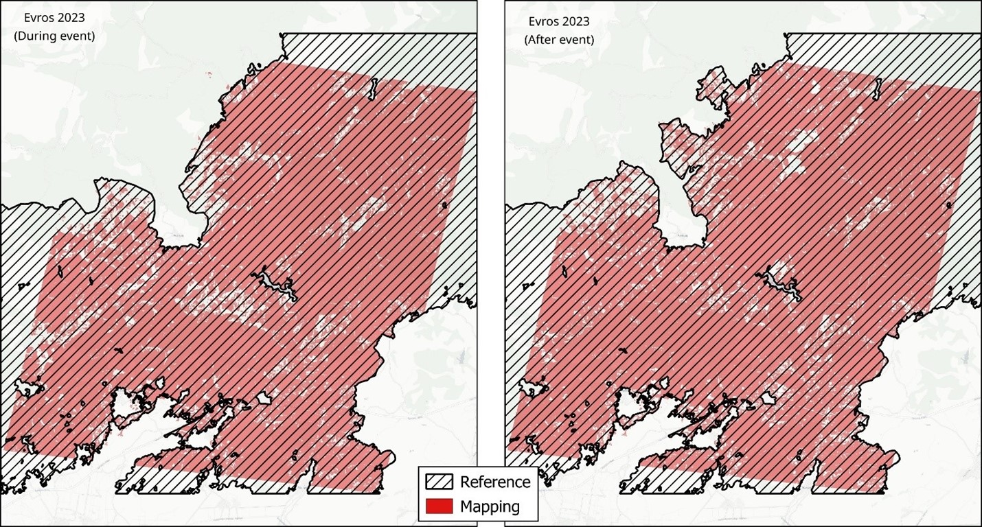
Offers near real-time and accurate wildfires maps, fire impact assessment, fuel type mapping and fire danger prediction. Designed for emergency response teams, insurers and tourism operators, our product combines satellite data from LEO and CCM missions with AI to deliver insights in near real-time.
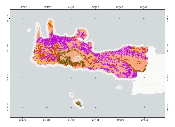
Fuel Type Mapping
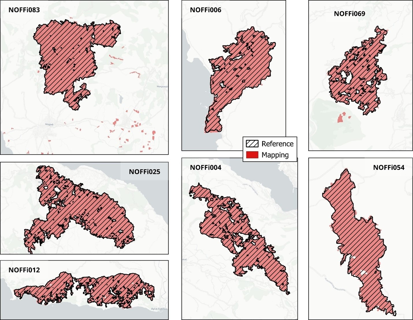
Burned Area Mapping
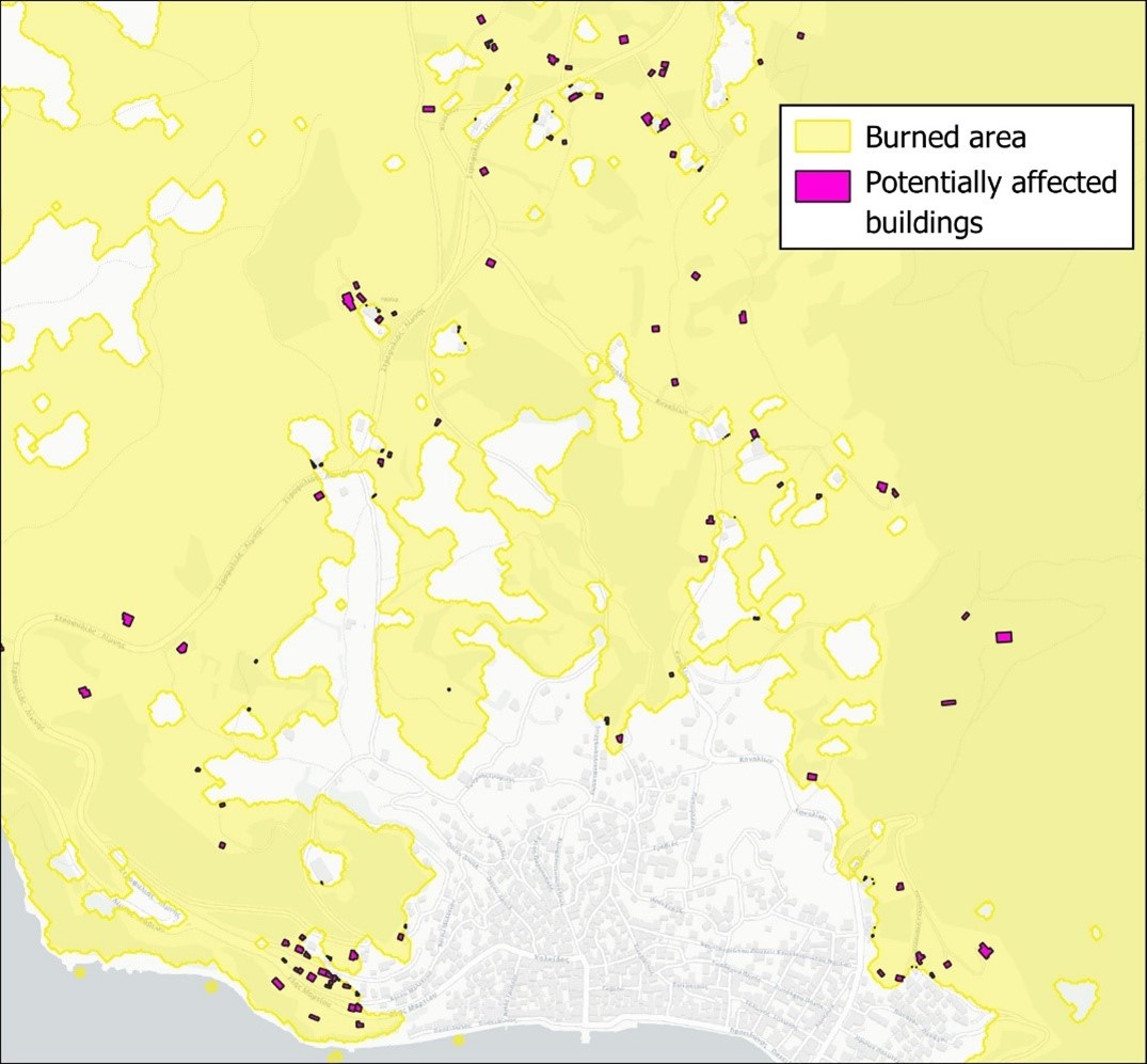
Fire Impact Assessment
Fire Danger Estimation
Tailored Notifications & Reports
Personalized alerts and automated reports delivered via web dashboard and email
Supports both real-time emergency response and long-term planning